Find the real owner of someone with a 319, 515, 563, 641, 712 Iowa area codes
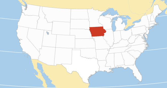
Iowa is reportedly one of the safest states to live in the United States. The Hawkeye state joined the union in 1846 and has since become an economic hub for agricultural, manufacturing, and financial businesses. Over three (3) million people live and work in Iowa. Information on residents and businesses with registered phone numbers is available on the Iowa phone number database.
Generally, an Iowa phone number begins with one of five area codes. Telephone companies began using area codes in 1947 as a better way to facilitate long-distance phone calls.
Before then, phone companies used switchboards. However, this system could not handle the volume of phone calls that came with the broader availability of telephones after world war II.
Another relic of the past is phonebook directories, aka white pages. These directories listed the name, address, and phone numbers of persons living in a small town or city block. However, just like switchboards, phonebook directories became inefficient when more people began to own phone numbers. Phone companies couldn’t just keep up with the cost of printing several editions of white pages every other month. Besides, white pages were often the targets of vandalism—people tore off pages for personal use or privacy reasons.
Iowa white pages are now available online and better. You can now access names and contact addresses by performing a reverse phone lookup on the Iowa phone numbers database. How does this work? When a resident purchases a phone number, their mobile carriers typically require them to register personal information and contact details. This registration and the uniqueness of a phone number make it possible to obtain information about a phone number owner with a reverse phone lookup.
Consider the typical Iowa phone number, 515-NXX-XXXX. The first three digits of the phone number, 515, is the area code for a defined city. The next three digits, NXX, the prefix code, specify the specific town or street where the phone number owner resides. Finally, the line number, XXXX, is unique to the specific owner. So, if the phone number were to be a house address, the line number would be a specific flat number or house number.
Many persons can have the same area code and prefix code. However, the line number is unique to a specific individual. No two persons have the same line number. Thus, when you perform a reverse phone search, you only get the information logged for the registered owner of that phone number.
| County | FIPS code | County seat | Established | Population | Area |
| Adair County | 001 | Greenfield | 1851 | 7,496 | 569 sq mi |
| Adams County | 003 | Corning | 1851 | 3,704 | 424 sq mi |
| Allamakee County | 005 | Waukon | 1847 | 14,061 | 640 sq mi |
| Appanoose County | 007 | Centerville | 1843 | 12,317 | 496 sq mi |
| Audubon County | 009 | Audubon | 1851 | 5,674 | 443 sq mi |
| Benton County | 011 | Vinton | 1837 | 25,575 | 716 sq mi |
| Black Hawk County | 013 | Waterloo | 1843 | 131,144 | 567 sq mi |
| Boone County | 015 | Boone | 1846 | 26,715 | 572 sq mi |
| Bremer County | 017 | Waverly | 1851 | 24,988 | 428 sq mi |
| Buchanan County | 019 | Independence | 1837 | 20,565 | 571 sq mi |
| Buena Vista County | 021 | Storm Lake | 1851 | 20,823 | 575 sq mi |
| Butler County | 023 | Allison | 1851 | 14,334 | 580 sq mi |
| Calhoun County | 025 | Rockwell City | 1851 | 9,927 | 570 sq mi |
| Carroll County | 027 | Carroll | 1851 | 20,760 | 569 sq mi |
| Cass County | 029 | Atlantic | 1851 | 13,127 | 564 sq mi |
| Cedar County | 031 | Tipton | 1837 | 18,505 | 580 sq mi |
| Cerro Gordo County | 033 | Mason City | 1851 | 43,127 | 568 sq mi |
| Cherokee County | 035 | Cherokee | 1851 | 11,658 | 577 sq mi |
| Chickasaw County | 037 | New Hampton | 1851 | 12,012 | 505 sq mi |
| Clarke County | 039 | Osceola | 1846 | 9,748 | 431 sq mi |
| Clay County | 041 | Spencer | 1851 | 16,384 | 569 sq mi |
| Clayton County | 043 | Elkader | 1837 | 17,043 | 779 sq mi |
| Clinton County | 045 | Clinton | 1837 | 46,460 | 695 sq mi |
| Crawford County | 047 | Denison | 1851 | 16,525 | 714 sq mi |
| Dallas County | 049 | Adel | 1846 | 99,678 | 586 sq mi |
| Davis County | 051 | Bloomfield | 1843 | 9,110 | 503 sq mi |
| Decatur County | 053 | Leon | 1846 | 7,645 | 532 sq mi |
| Delaware County | 055 | Manchester | 1837 | 17,488 | 578 sq mi |
| Des Moines County | 057 | Burlington | 1834 | 38,910 | 416 sq mi |
| Dickinson County | 059 | Spirit Lake | 1851 | 17,703 | 381 sq mi |
| Dubuque County | 061 | Dubuque | 1834 | 99,266 | 608 sq mi |
| Emmet County | 063 | Estherville | 1851 | 9,388 | 396 sq mi |
| Fayette County | 065 | West Union | 1837 | 19,509 | 731 sq mi |
| Floyd County | 067 | Charles City | 1851 | 15,627 | 501 sq mi |
| Franklin County | 069 | Hampton | 1851 | 10,019 | 582 sq mi |
| Fremont County | 071 | Sidney | 1847 | 6,605 | 511 sq mi |
| Greene County | 073 | Jefferson | 1851 | 8,771 | 568 sq mi |
| Grundy County | 075 | Grundy Center | 1851 | 12,329 | 503 sq mi |
| Guthrie County | 077 | Guthrie Center | 1851 | 10,623 | 591 sq mi |
| Hamilton County | 079 | Webster City | 1856 | 15,039 | 577 sq mi |
| Hancock County | 081 | Garner | 1851 | 10,795 | 571 sq mi |
| Hardin County | 083 | Eldora | 1851 | 16,878 | 569 sq mi |
| Harrison County | 085 | Logan | 1851 | 14,582 | 697 sq mi |
| Henry County | 087 | Mount Pleasant | 1836 | 20,482 | 434 sq mi |
| Howard County | 089 | Cresco | 1851 | 9,469 | 473 sq mi |
| Humboldt County | 091 | Dakota City | 1857 | 9,597 | 434 sq mi |
| Ida County | 093 | Ida Grove | 1851 | 7,005 | 432 sq mi |
| Iowa County | 095 | Marengo | 1843 | 16,662 | 586 sq mi |
| Jackson County | 097 | Maquoketa | 1837 | 19,485 | 636 sq mi |
| Jasper County | 099 | Newton | 1846 | 37,813 | 730 sq mi |
| Jefferson County | 101 | Fairfield | 1839 | 15,663 | 435 sq mi |
| Johnson County | 103 | Iowa City | 1837 | 152,854 | 614 sq mi |
| Jones County | 105 | Anamosa | 1837 | 20,646 | 575 sq mi |
| Keokuk County | 107 | Sigourney | 1837 | 10,033 | 579 sq mi |
| Kossuth County | 109 | Algona | 1851 | 14,828 | 973 sq mi |
| Lee County | 111 | Fort Madison and Keokuk | 1836 | 33,555 | 517 sq mi |
| Linn County | 113 | Cedar Rapids | 1837 | 230,299 | 718 sq mi |
| Louisa County | 115 | Wapello | 1836 | 10,837 | 402 sq mi |
| Lucas County | 117 | Chariton | 1846 | 8,634 | 431 sq mi |
| Lyon County | 119 | Rock Rapids | 1851 | 11,934 | 588 sq mi |
| Madison County | 121 | Winterset | 1846 | 16,548 | 561 sq mi |
| Mahaska County | 123 | Oskaloosa | 1843 | 22,190 | 571 sq mi |
| Marion County | 125 | Knoxville | 1845 | 33,414 | 554 sq mi |
| Marshall County | 127 | Marshalltown | 1846 | 40,105 | 572 sq mi |
| Mills County | 129 | Glenwood | 1851 | 14,484 | 437 sq mi |
| Mitchell County | 131 | Osage | 1851 | 10,565 | 469 sq mi |
| Monona County | 133 | Onawa | 1851 | 8,751 | 693 sq mi |
| Monroe County | 135 | Albia | 1843 | 7,577 | 433 sq mi |
| Montgomery County | 137 | Red Oak | 1851 | 10,330 | 424 sq mi |
| Muscatine County | 139 | Muscatine | 1836 | 43,235 | 439 sq mi |
| O’Brien County | 141 | Primghar | 1851 | 14,182 | 573 sq mi |
| Osceola County | 143 | Sibley | 1851 | 6,192 | 399 sq mi |
| Page County | 145 | Clarinda | 1847 | 15,211 | 535 sq mi |
| Palo Alto County | 147 | Emmetsburg | 1851 | 8,996 | 564 sq mi |
| Plymouth County | 149 | Le Mars | 1851 | 25,698 | 864 sq mi |
| Pocahontas County | 151 | Pocahontas | 1851 | 7,078 | 578 sq mi |
| Polk County | 153 | Des Moines | 1846 | 492,401 | 570 sq mi |
| Pottawattamie County | 155 | Council Bluffs | 1847 | 93,667 | 954 sq mi |
| Poweshiek County | 157 | Montezuma | 1843 | 18,662 | 585 sq mi |
| Ringgold County | 159 | Mount Ayr | 1847 | 4,663 | 538 sq mi |
| Sac County | 161 | Sac City | 1851 | 9,814 | 576 sq mi |
| Scott County | 163 | Davenport | 1837 | 174,669 | 458 sq mi |
| Shelby County | 165 | Harlan | 1851 | 11,746 | 591 sq mi |
| Sioux County | 167 | Orange City | 1851 | 35,872 | 768 sq mi |
| Story County | 169 | Nevada | 1846 | 98,537 | 573 sq mi |
| Tama County | 171 | Toledo | 1843 | 17,135 | 721 sq mi |
| Taylor County | 173 | Bedford | 1847 | 5,896 | 534 sq mi |
| Union County | 175 | Creston | 1851 | 12,138 | 424 sq mi |
| Van Buren County | 177 | Keosauqua | 1836 | 7,203 | 485 sq mi |
| Wapello County | 179 | Ottumwa | 1843 | 35,437 | 432 sq mi |
| Warren County | 181 | Indianola | 1846 | 52,403 | 572 sq mi |
| Washington County | 183 | Washington | 1839 | 22,565 | 569 sq mi |
| Wayne County | 185 | Corydon | 1846 | 6,497 | 526 sq mi |
| Webster County | 187 | Fort Dodge | 1853 | 36,999 | 715 sq mi |
| Winnebago County | 189 | Forest City | 1851 | 10,679 | 400 sq mi |
| Winneshiek County | 191 | Decorah | 1847 | 20,070 | 690 sq mi |
| Woodbury County | 193 | Sioux City | 1853 | 105,941 | 873 sq mi |
| Worth County | 195 | Northwood | 1851 | 7,443 | 400 sq mi |
| Wright County | 197 | Clarion | 1851 | 12,943 | 581 sq mi |